Now that we’re sitting in Indiantown Marina and it’s obvious that we’re going to be here for quite a long time while we fix up Daze Off to sail, I don’t want to bore you with stories that are only related to boat work (but don’t worry, they’re still coming).  I know that’s what some of you crave, but if you’re like me, you also need a little fun in there.  A little travel and a little adventure.
So for the foreseeable future while we are doing nothing much more than boat work I will be adding a Throwback Thursday post in every week as well.  Cataloging our trip so far, giving you that needed sense of travel and adventure, and for those of you that haven’t started with us from the beginning, catch you up on some of the most important or memorable parts of our travels.
Even though both of us were ennamored with our time in Madeira, I never seemed to pull out my camera much for my time there. Â Maybe it was a good thing though, as I was just enjoying being there instead of being there as a tourist with the need to capture every outing.
There were times I did make missions to go out with camera in hand though, like when I hiked to the top of a tall hill in town to catch the sunset, or the one time we met some young people to hang out with from the marina. (Spoiler alert: Norwegians can drink a lot).  We also took a trip out to the local market one morning  as it was touted as a ‘must experience’ through Trip Advisor reviews there, but we were sorely disappointed with what we got.
One morning we decided to see further than what the main city of Funchal had to offer. Â Hoping on a local bus, we rode around to the opposite side of the island to check out a hiking trail up a volcano that our new Norwegian friends told us about. Â Once arriving though, we found out that our friends are much more adventurous than us, and I should have listened to the woman at the information station about the weather.
You can find the original post here.
Thursday October 16, 2014
I don’t have to tell you how in love we are with this island. Â I’ve pretty much been talking about it non stop lately. Â The only problem is, I can’t quite say we love this island just yet, because we’ve only seen Funchal. Â I’m sure I could fall deeply in love with the rest of it, I just needed a chance to see it.
So with great public transportation and nothing but time on our hands as we wait for a decent window to the Canaries, I kept bugging Matt that we needed to do an inland tour. Â See more than just this one town. Â So that years down the road when we finally give up our life at sea and get our land legs back I can say with authority, ‘We should move to Madeira. Â We loved that entire island.’
I had spent hours online researching the best places of the island to visit, but with only a bus at our fingertips instead of a car it wouldn’t be as easy to see multiple parts and we’d have to stick to one area.  Looking at photo after photo and spending one whole evening on a certain flickr account, I decided that São Vicente on the north side of the island was the place for us.  It looked as if it had a gorgeous beach with high rising cliffs on each side, a quaint little town for wandering, and caves to explore should the mood hit.  I was all set to buy our bus tickets out.
That was, until we ran into the Norwegian guys the morning of their departure.  We had noticed that they’d been gone the entire previous day and found out they went on an amazing hike through the center of the island from Pico Ruivo to Pico Areeiro.  They described it as very long at 15 km total, difficult at times as most of it was uphill, but by far one of the best hikes they’ve ever taken in their life.  “It challenges hiking through the fjords of Norway”, they told me.  It did sound incredibly long and tedious, but how could you pass up something right in front of you that challenges the views of Norway?  That night I researched Pico Areeiro and decided that São Vicente would have to wait. We were going to hike a mountain.
Stopping at the information center in Funchal I picked up a few maps as the woman behind the counter stared at me with leery eyes as I told her my plans. Â “It’s a very long walk”, she told me. Â “Yes”, I replied, “I’m fully aware. Â It will be about six hours”. Â “Tomorrow is supposed to be very bad weather”, she confronted. Â I paid her no mind. Â For some reason the woman of Portugal don’t seem to like me and are always telling me I can’t or shouldn’t do things that I later find are incredibly easy. Â Like lugging our propane containers a mile outside town to have them filled instead of getting a taxi.
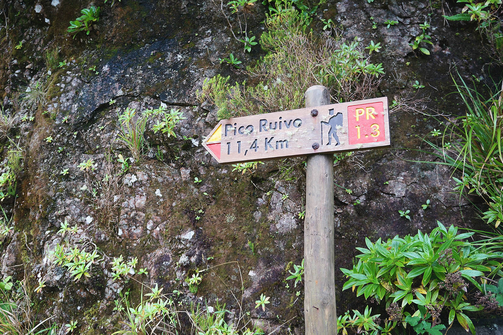
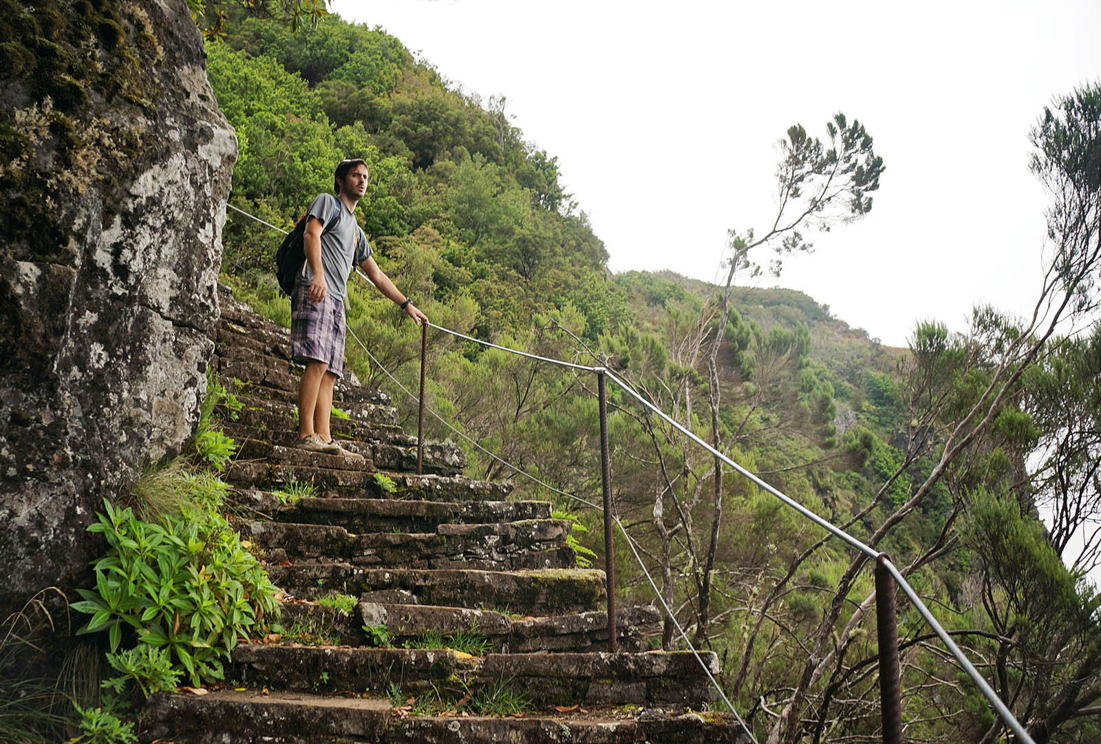
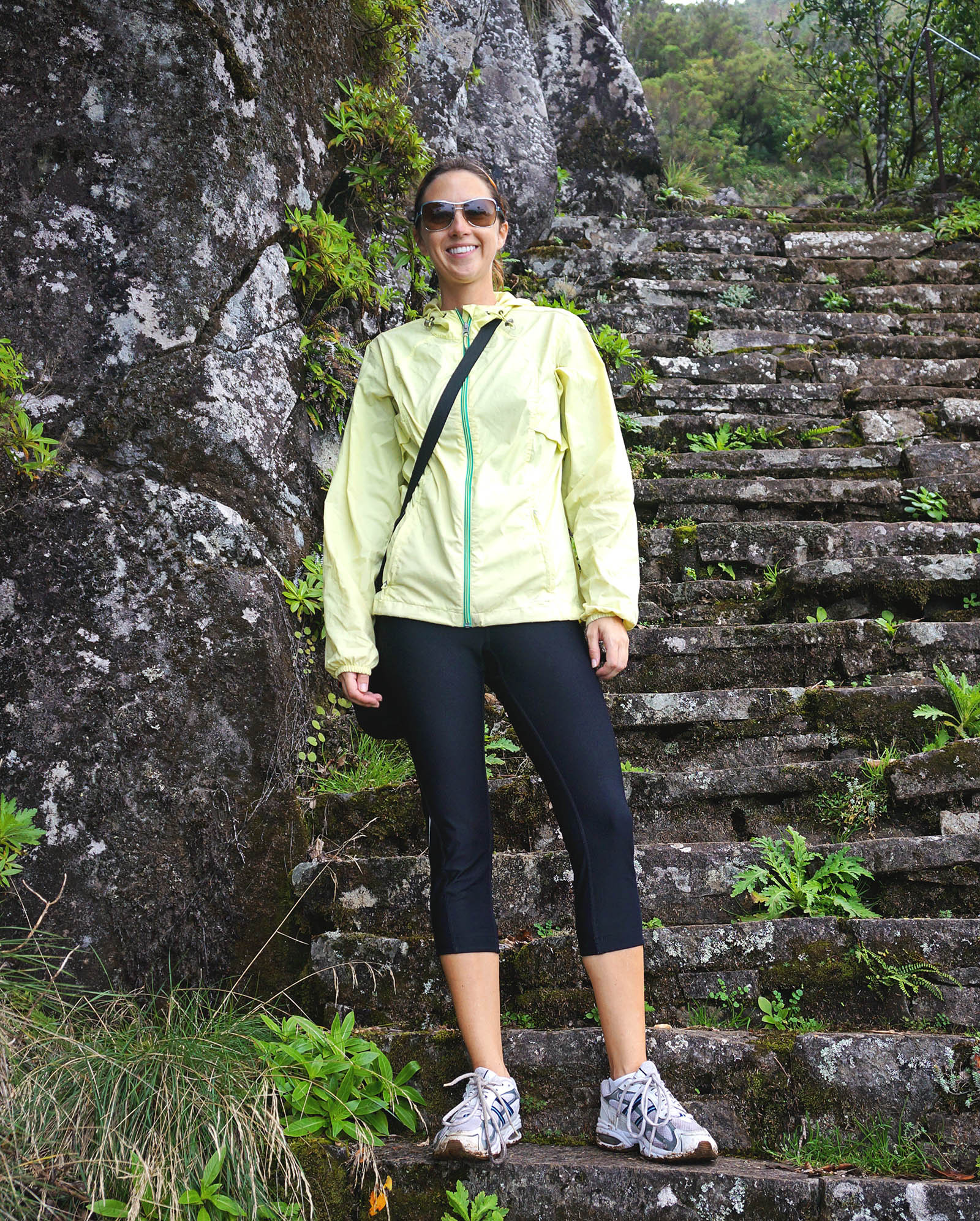
So as we woke this morning I prepared us the best I could, dressing us in layers for the elevation and even putting in a windbreaker since I remembered the fresh breeze at the top of Faial, although Matt declined his. Â Hopping on the bus we rode through extremely beautiful seaside and mountain roads until we began climbing to the interior town of Encumeada where we would then follow the 11 km path to Pico Ruivo and from there continue on about another 5 km to Pico Areeiro. Â Encumeada would start us at an elevation of 1007 m , the climb up to Pico Ruivo would bring us up to 1862 m, and we’d descend to Pico Areeiro just a little bit at 1816 m, although this was supposed to be the more difficult part of the hike, winding through extremely narrow paths and through caves in the mountains.
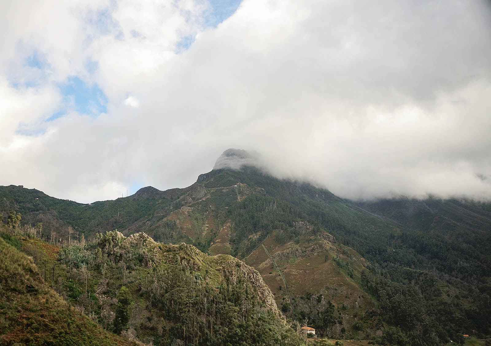
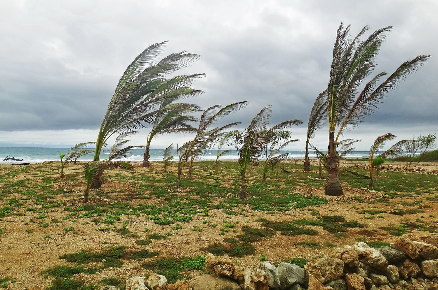
As the bus chugged and climbed it’s way up the mountain we watched the sun disappear and a thick fog settled in.  The winds were picking up as well and just as we started to laugh and point out how quickly they were rushing through this area, whipping around peaks and pushing bushes on their side, the bus driver stopped and motioned for us to get off.  Oh crap.  This did not look so fun anymore.  Stepping off the bus into 40 knot winds and a 20 degree temperature drop, we began to second guess ourselves as the bus sped away down the mountain toward São Vicente.
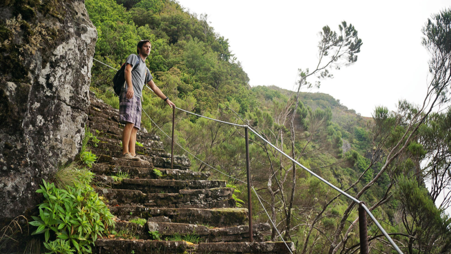
Bundling ourselves up in every layer of clothing we had on us, we found the beginning of the trail while at the same time muttering to ourselves ‘How the hell are we going to do this?’. Â At this point we were pretty sure that the two of us together would not be coming back down alive. Â Pushing our way up a dirt trodden path we found a bit of sanctuary behind the giant ridges in front of us, the wind luckily coming from the opposite side. Â The side we were on still held it’s challenges though in the form of never ending steps. Â This was not looking like it was going to be a gradual path up those 850 m. Â Climbing and huffing and puffing we tried to gauge how much initial elevation we were making, hoping that it was all at the beginning and the rest would level out. Â That we might be able to handle. Â But if it was going to be 11 km of climbing stairs, that was a guarantee that neither of us would be making it back down.
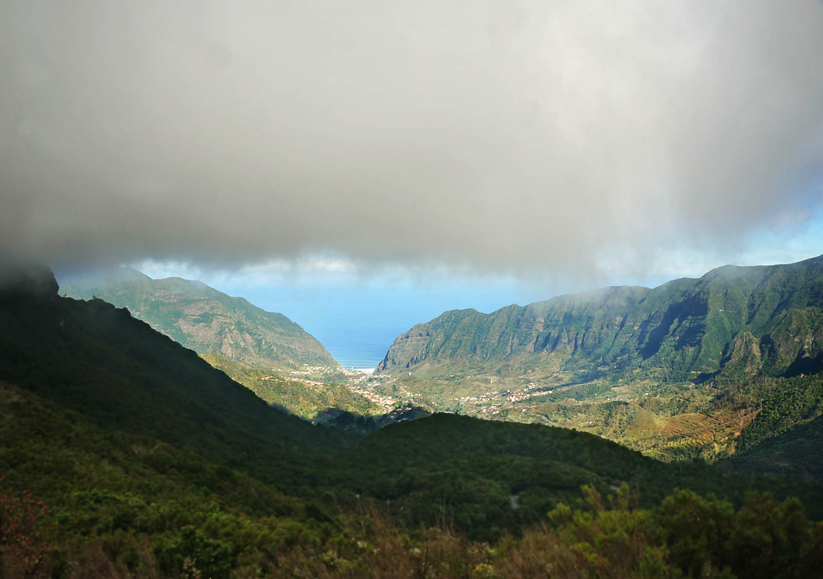
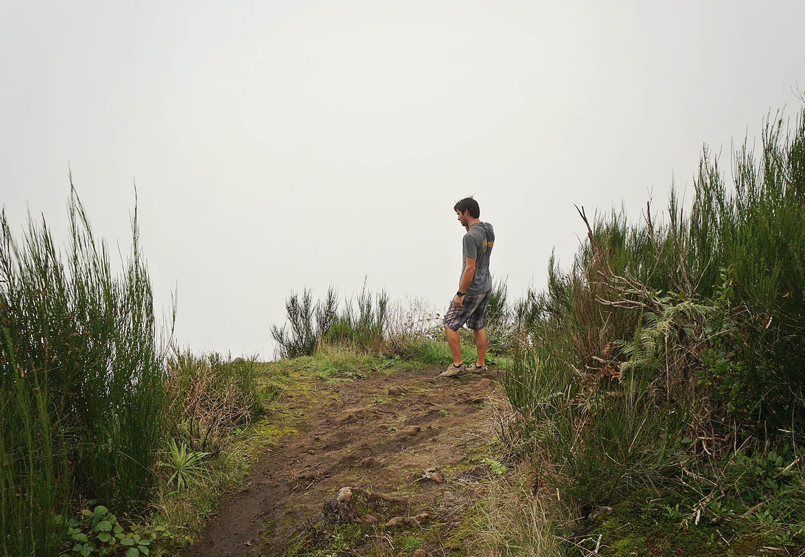
On the bright side, during many of our breaks to stop and catch our breath we had amazing views down the cliffs to the north side of the island where São Vicente was nestled at the bottom.  The clouds on that side of us cleared just enough for us to see out to the valley below, but whenever we turned to look where we were headed next it was nothing but white.  We began to wonder if the hike would be worth it at all, coming mostly for the views and realizing there was a chance we wouldn’t even be able to make them out through the fog.
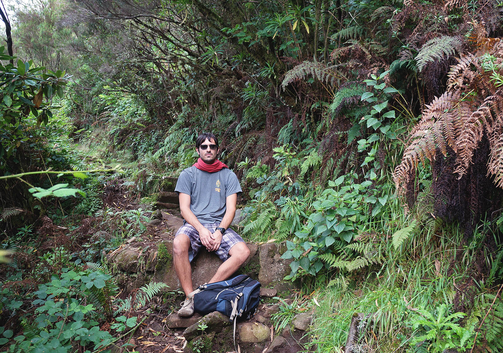
On and on we continued to huff and puff as we climbed higher and higher. Â The rocky stones in the dirt path would sometimes give way to grand staircases, but the theme always seemed to be onward and upward. Â For a few moments we had forgotten about the wind since there had been no exposure to it since the beginning of the hike. Â While rising up one of these grand stair cases we found another couple close to our age coming back down. Â They stopped to chat for a moment, both of us asking where the other was heading. Â It turns out they were trying to do the same hike as us, or at least just get to the top of Pico Ruivo, but about a quarter mile up ahead they found themselves exposed to the wind again and decided to turn around.
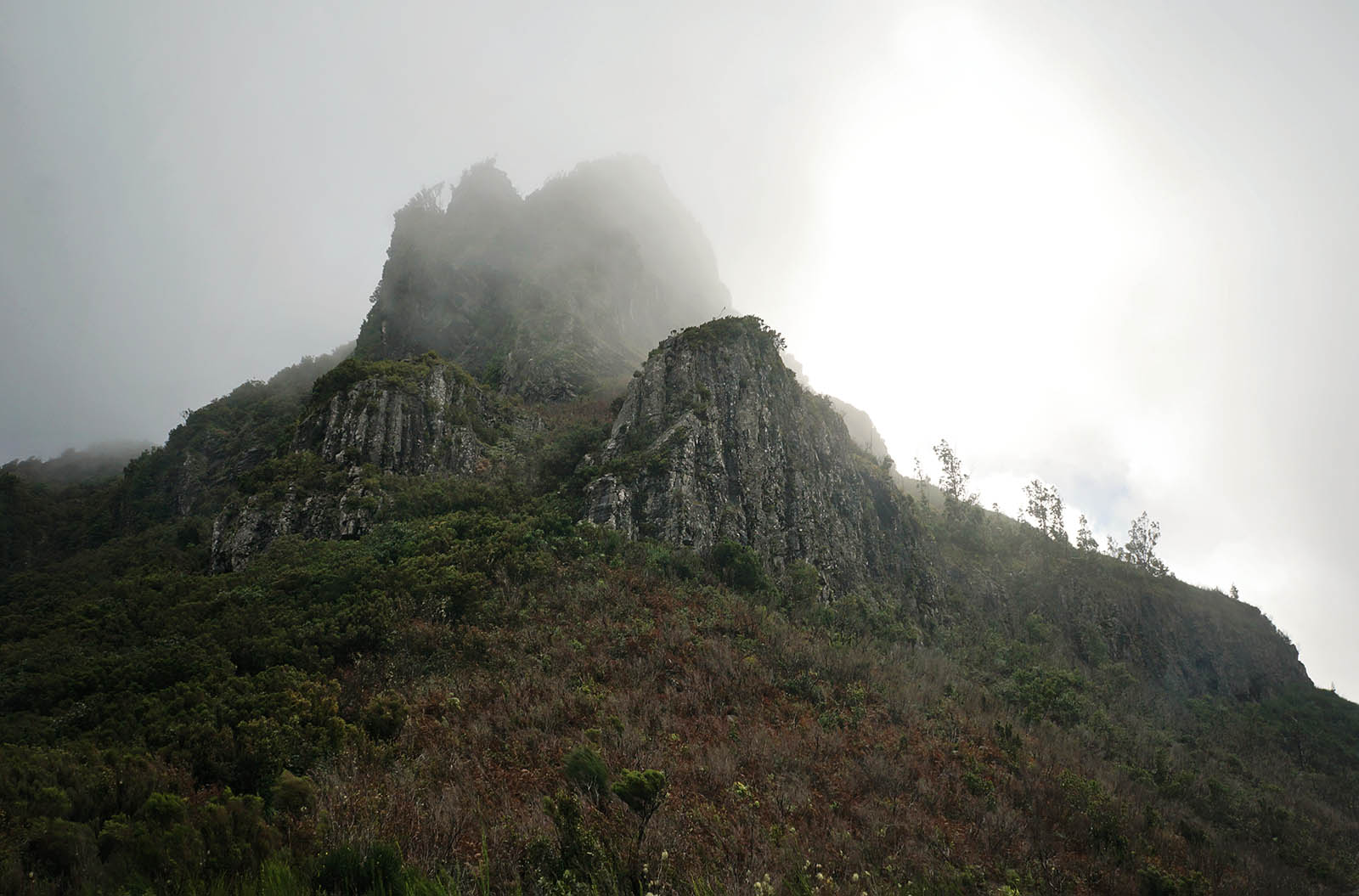
As the guy tried to explain, we think they were French and English was a second language, they were by no means professionals and they felt that to continue would be too dangerous and they were better off coming back down and completing their tour of the island from the safety of their rental car. Â We don’t consider ourselves professionals either, but can sometimes muster ourselves up to be hardcore for just a little bit, and decided to continue on. Â At least to the point they were referring to and could decide there if we wanted to move forward or turn around. Â Progressing up the mountain another ten minutes we came up to a clearing that had no protection from the strong winds we initially experienced and suddenly saw exactly what they were talking about.
The winds here hit us like a freight train, suddenly gusting up from a light breeze to somewhere near 60 knots. Â Not only that, but we were in complete cloud cover and could not see more than 100 feet in front of us. Â No wonder this other couple turned around. Â To venture on looked like suicide. Â We quickly agreed that to continue on would be completely unwise and possibly even dangerous and we also turned ourselves around, even rushing back down the areas we could, trying to catch this couple to see if maybe they would give us a ride back into town instead of waiting for the bus to swing around again that afternoon.
Back at the bottom of the hill the French couple was long gone and the next bus through this area was still hours away from arriving.  Scouting the small diner and gift shop that made up this town we looked for vehicles of only two people that might be able to give us a ride back to Funchal or at least down the mountain to São Vicente, but every car or van we came across was packed full.  Giving up we decided to walk the 10 km ourselves since we figured we had planned on getting a hike in that day anyway and at least this was downhill.
This notion only lasted about half the way down until it felt like we were never going to reach our destination. Â Every time we’d round a corner and look down the valley we’d think, ‘Ok, only about two more turns and we should be there’, except every turn led to at least five more. Â Finally at one lookout point we broke down and asked a couple that had stopped to enjoy the views if they could give us a lift the remaining few miles. Â They kindly obliged and our weary legs finally had a rest.
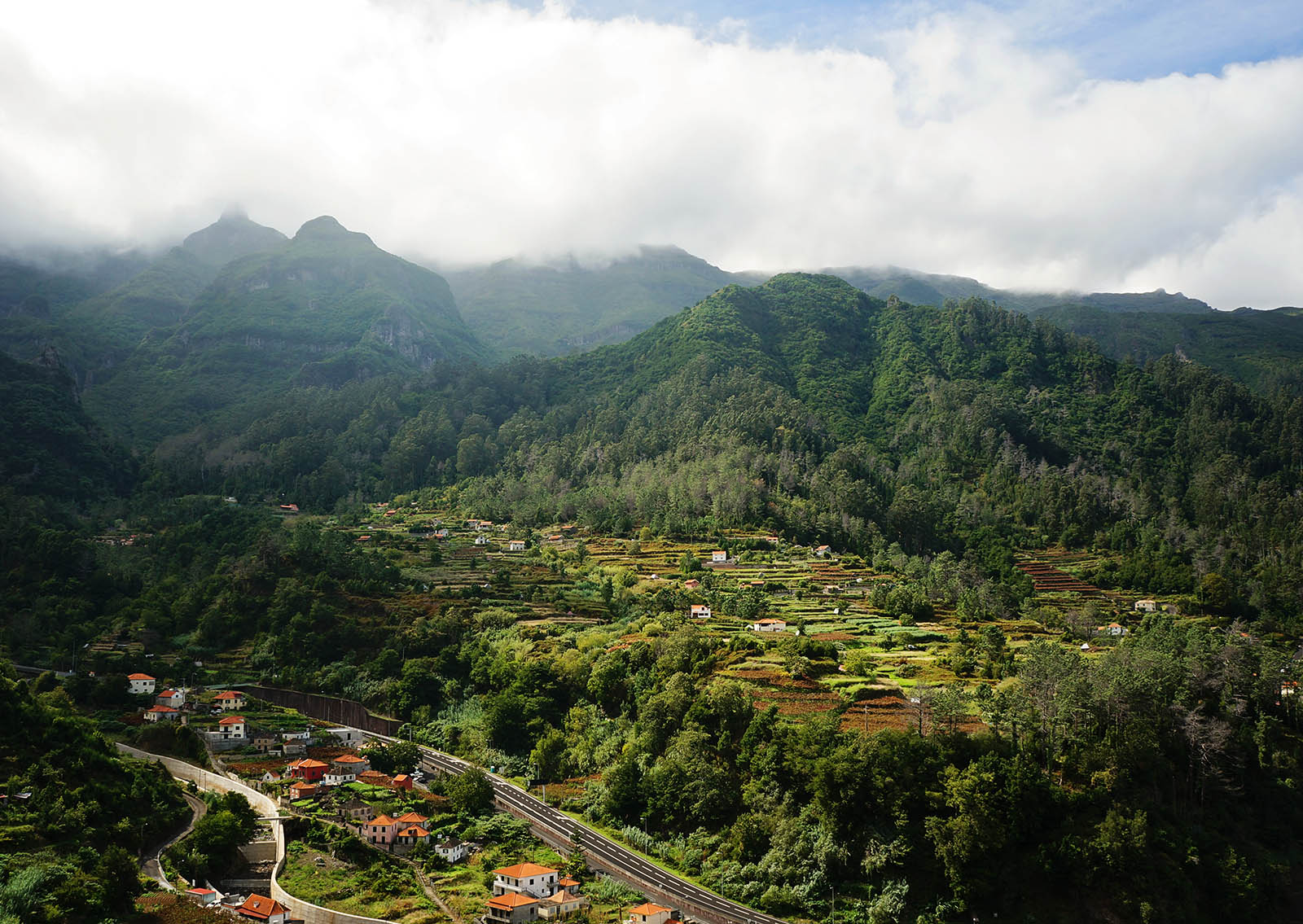

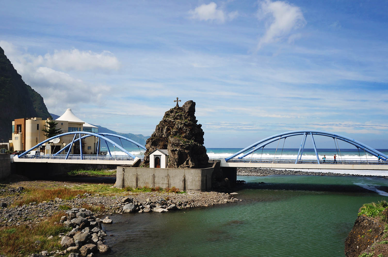
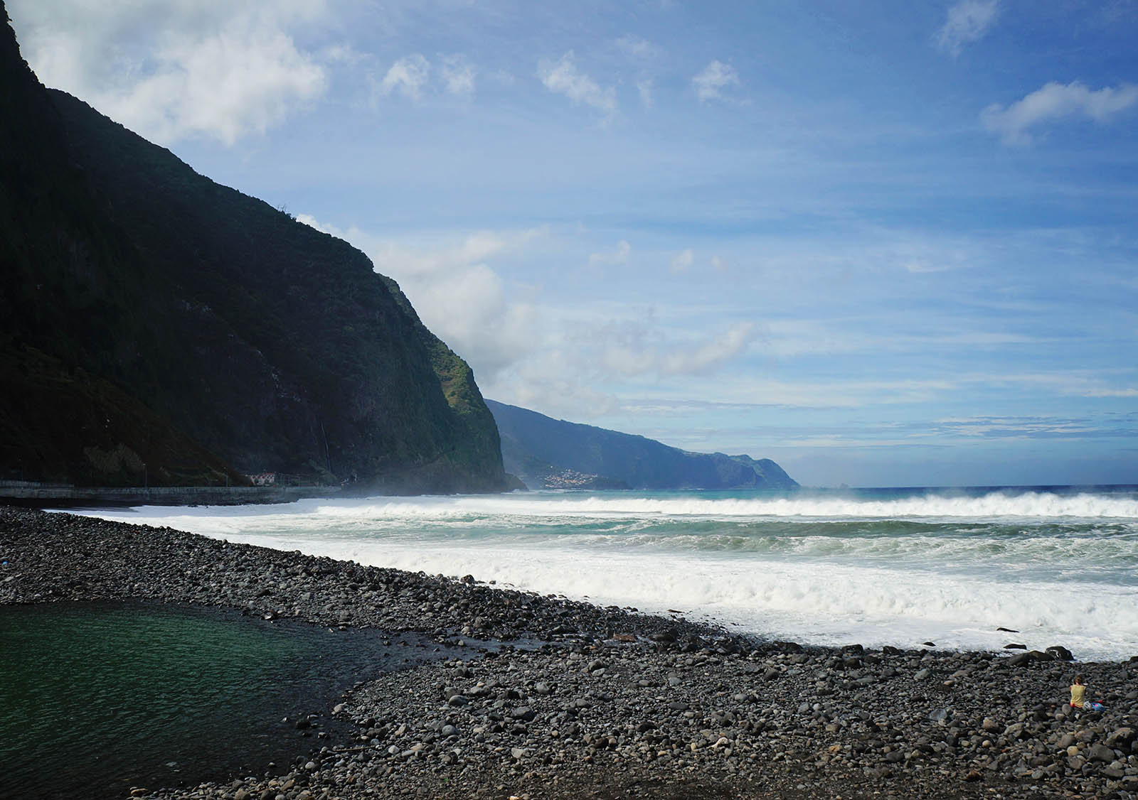
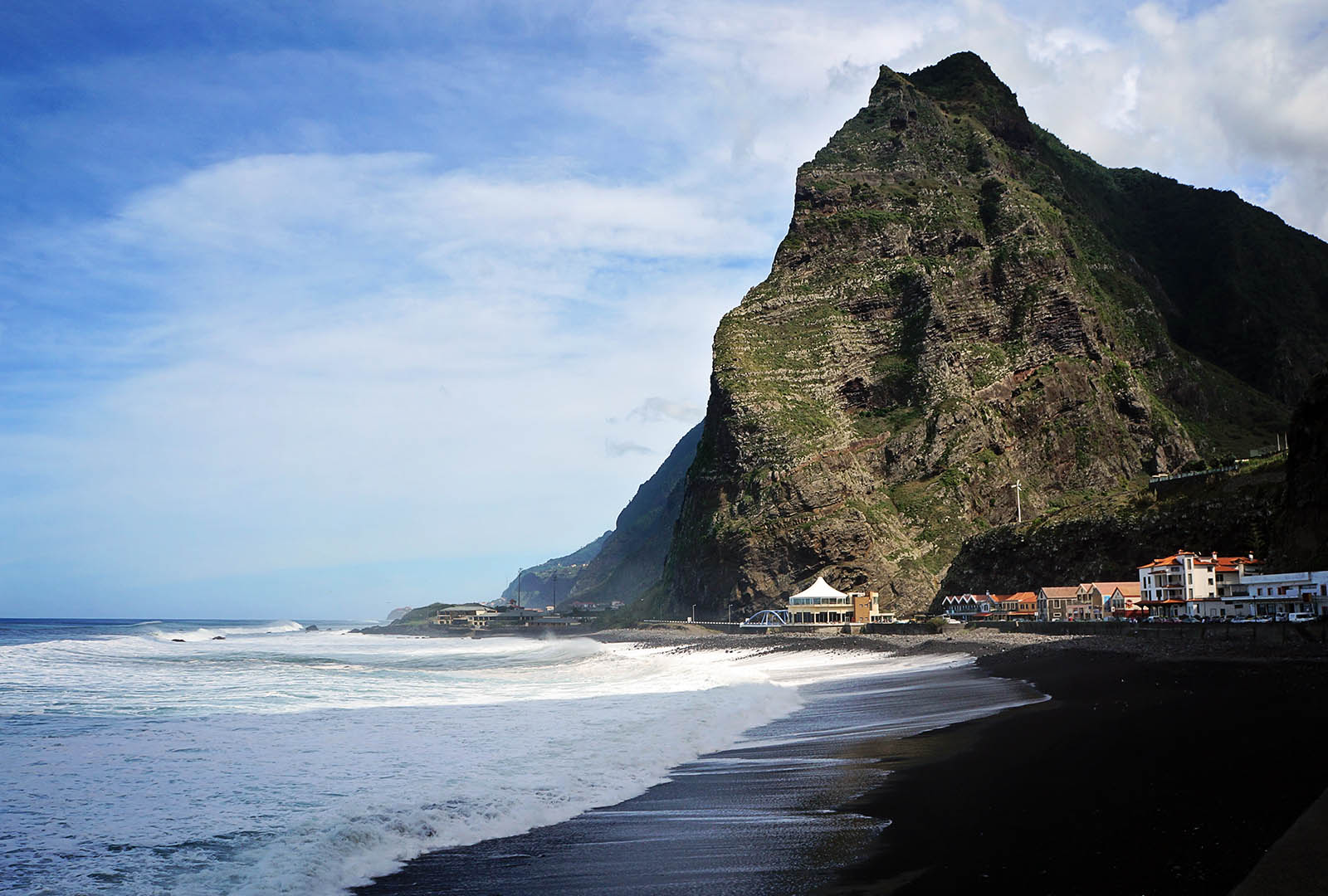
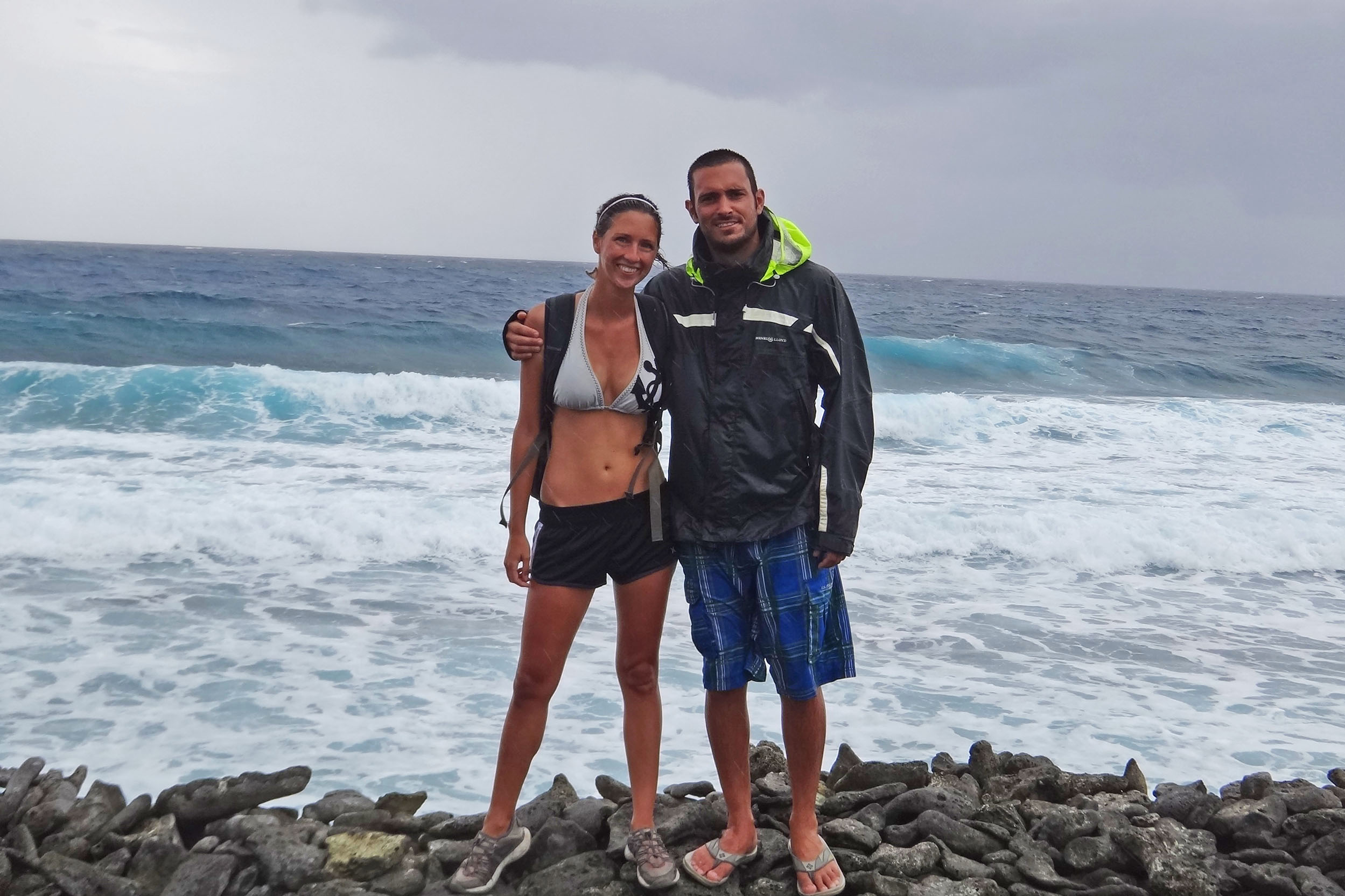
 When we got down to São Vicente we realized the town itself didn’t have a whole lot going for it.  Not that it was a bad place, it was just much smaller than we were expecting.  There were a few shops, lots of restaurants, but that was about it.  Coming from the metropolis of Funchal though, I can see how anything could look kind of small.
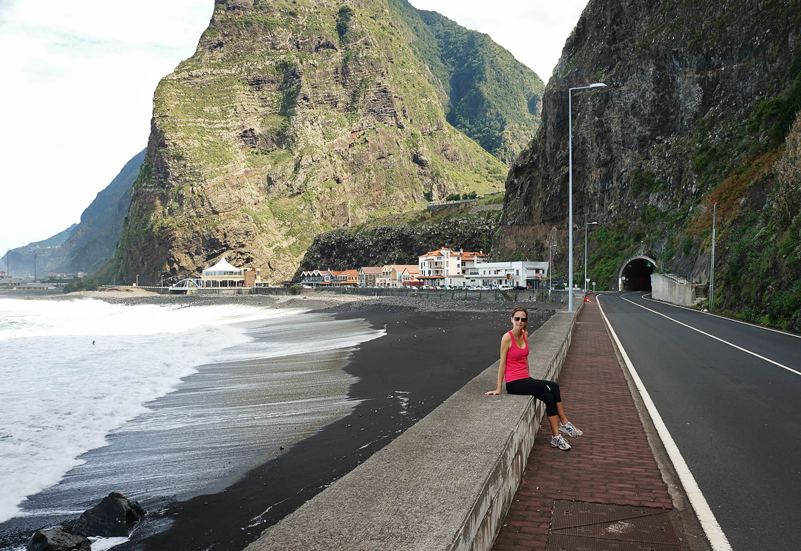
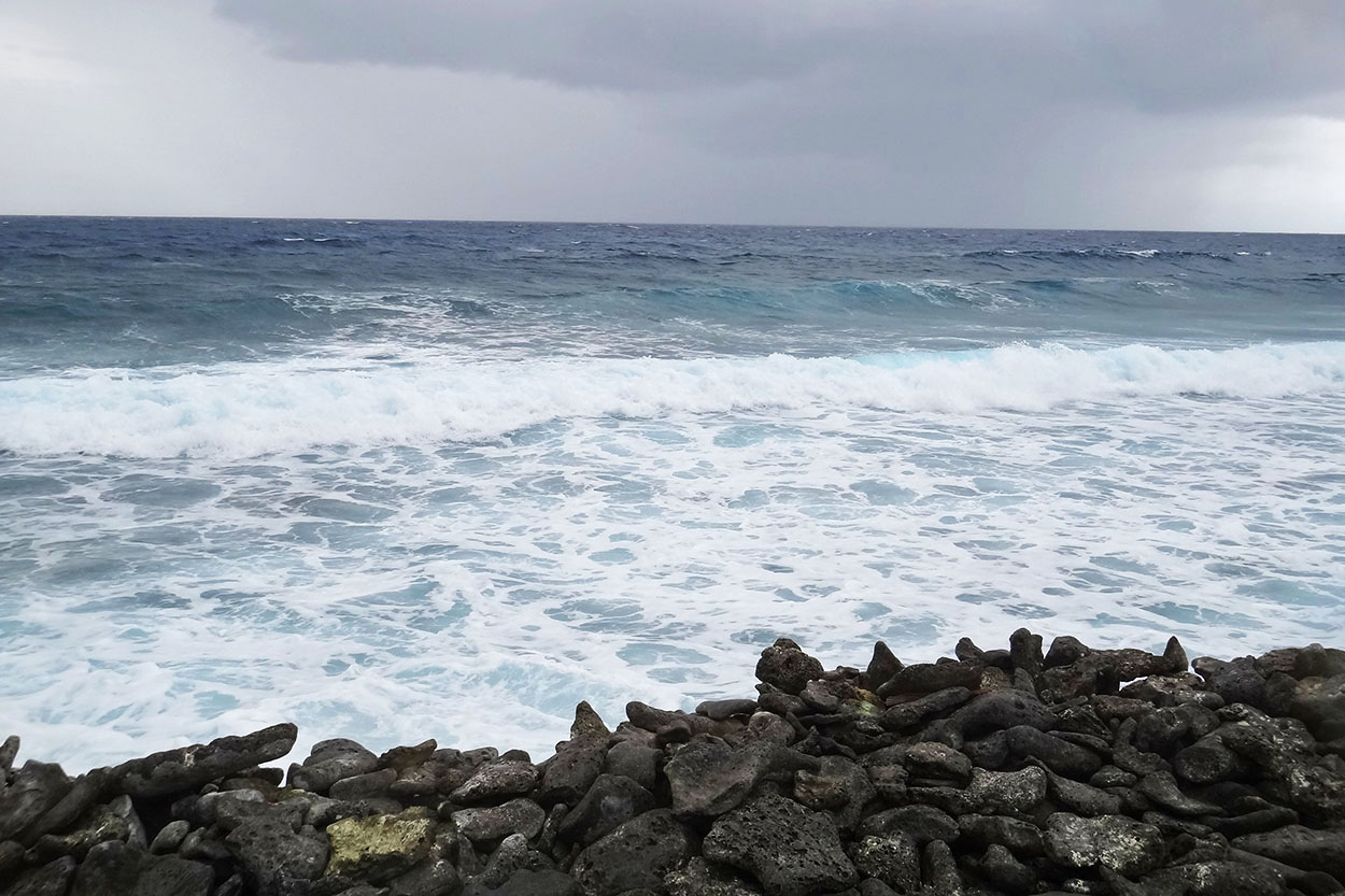
What the town lacked though, the seaside definitely made up for. Â There were gorgeous black sand beaches with tremendous waves constantly crashing on them. Â A true surfers paradise. Â With an hour to kill before the next bus would come around to bring us home, we just sat on the seawall and took in the views of the staggering cliffs that sat on the ocean while thundering waves crashed at their feet.
In the end, I guess the day worked out kind of perfectly.  I doubt we would have had the strength to hike the entire way to Pico Areelio even on a clear and calm day, but there also wasn’t enough in São Vicente to entertain us for an entire day.  So breaking it up between the two gave us a taste of both worlds.  It also gave us a chance to see more than just one spot on the island and let me say for sure that Yes, I could absolutely see myself living here someday.
Here’s a quick little clip of some of our sights for the day.


")
")
")
")
")
")
")
")
")
")