Monday August 13, 2012
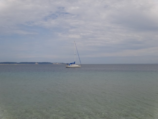
When we pulled into the harbor at South Manitou Island I was estatic to see the sun coming through patches in the clouds and thought maybe we’d actually be able to do some real sightseeing instead of bundling up in winter gear for a 20 minute trek to the lighthouse  before going back to the boat and spending the rest of the day inside as I had envisioned. Looking at the chart for a good anchorage we steered clear of the only other sailboat in the harbor and dropped our anchor in 40 feet of clear aqua water. Cleaning up the mess we managed to make in the cockpit I glanced around for our best bathing option since neither of us had showered in two and a half days. We definitely needed to clean up. Since the three containers of deisel were taking up the floor of the cockpit and we don’t have our watermaker set up yet, a cockpit shower was not looking good. Checking the temperature of the water it was reading 66 degrees and I thought there was absolutely no way I was going to jump in and a bucket bath on deck may be the only option. But looking into the tantalizing clear bay I knew I couldn’t give up a chance to swim in these waters. We threw on our suits and although I prepared myself for a dive off the side I couldn’t muster up the courage and ended up slowly going down the ladder and took the plunge half way through. Let’s just say the water was refreshing enough to leave me short of breath. While I was busy paddling around and trying to get used to the cold, Matt made his way down the ladder as well but was out again as soon as he had submerged. Soon we were both clean and felt a million times better. I’m not missing the call of a hot shower just yet, but it probably won’t be too long.
After throwing on fresh clothes and eating a quick lunch of PB&J we jumped in the dinghy for a shore excursion. I didn’t know much of what was on this island except for a lighthouse that I really wanted to climp to the top of. Walking up the ferry dock as it was loading to take passengers back to Leeland we found a visitor’s stand next to the ranger’s house with a map of what was on the island. Looking through the options there was the lighthouse, the Giant Cedar Forest, a shipwreck and a path to the top of the dunes, apparently the highest one in Michigan. We assumed the shipwreck was viewable from the dunes and the path showed the cedar forest on the way so off we went on the unmarked roads, trying to remember which direction the map had pointed us since they were all out of the paper maps to take with you.
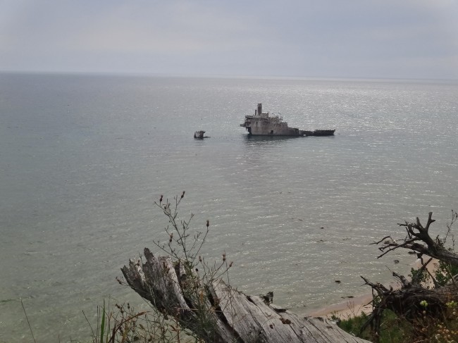
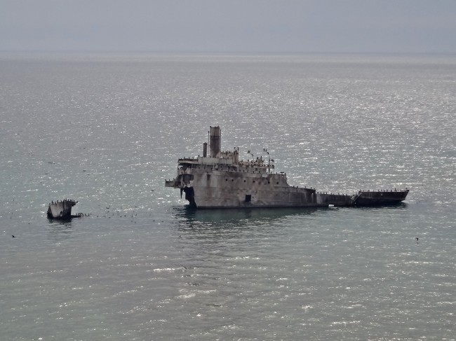
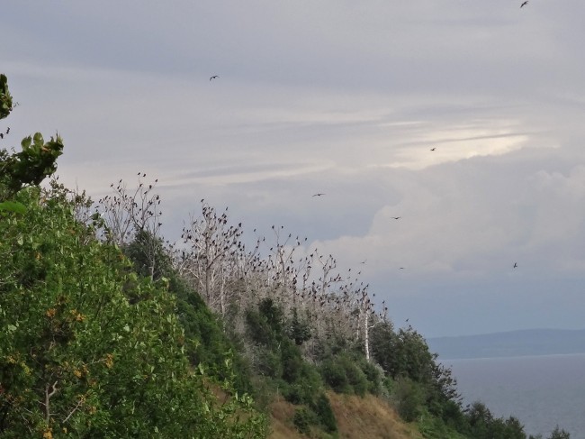
Walking a good 2 ½ miles we came across the path for the shipwreck and turned on it. Winding through the woods we were let out to the top of a bluff overlooking the water and a very large ship sticking out of it. I had thought it would just be a small portion protruding out of the water, maybe a smokestack or something of the sort, but this was basically the whole boat. Matt knew a little bit about it and told me it was from the 60’s and accidentally came aground on the rocks lining the island. Now falling apart it just sat in the shallow water with hundreds of birds perched on it’s deck.
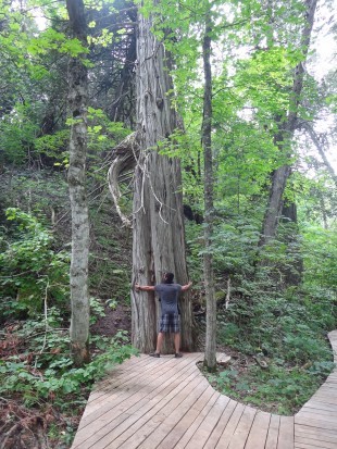
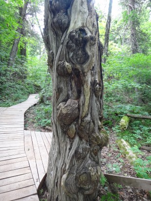
Going back out to the trail we followed it for another half mile until we came to the trail for the cedar forest. Neither of us knew if we should just be looking around as they’d be on the path or if there would be a marker once we arrived at them. Sure enough once you got to it there were cedar planks and benches laid down, following a path to bring you around to all the indeed giant trees. Some of them were very wide and some just very tall, but they were all warped and knotted and beautiful. We followed the cedar path until it deaded ended into a dirt trail and followed that hoping it would lead us back out to the main path. The dirt trail took us by a few more cedars in the woods and one very large cedar that had fallen and had a circumfrence almost taller than me.
Being spit out back on the path we made our way to the last stop on the trails, the dunes. Making our way up some steep dirt steps it opened into a sandy path that still led up and up. Getting quite out of breath as we had now been hiking over three miles up and down all kinds of hills we took a quick break, letting the breeze of the open air flow over us. Not sure which direction to head since there were now small sand trails going everywhere we picked one that looked like it had the most travelers and continuted to walk through the sand. (By the way, we did not see one other person on our hike on an island full of campers, very strange)
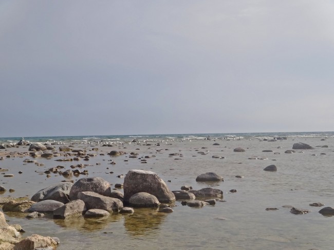
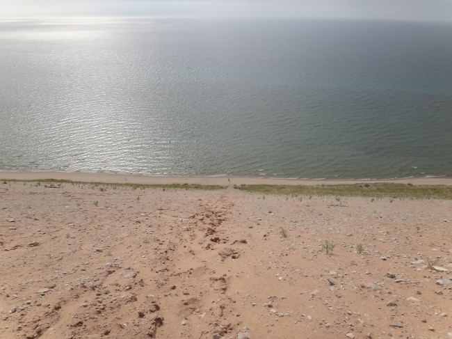
Going up and down a few more small dunes we came to the shore on top of a bluff about 400 feet above the water. Instead of walking back through all the trails we had just taken to get back to the bay, Matt suggested we go down the dune/bluff to the water and just hug the coast to get back. It may not have been shorter but the surface would be flat. Not wanting to go uphill anymore and knowing I’d have a constant breeze on my face by the water I agreed and down we went. After unloading the piles of sand we accumulated in our shoes we continued down the shore. Walking for at least a mile and rounding a few corners and not seeing the shipwreck we wondered if we made the completely wrong decision and would be walking all night. One more corner though and it was jutting out of the water so we figured we couldn’t be too far since it was only a two mile walk to this point from the inland trails. On and on we walked, now starting to get blisters on our feet and ready to get back to the boat for a nice dinner of grilled chicken and rice.
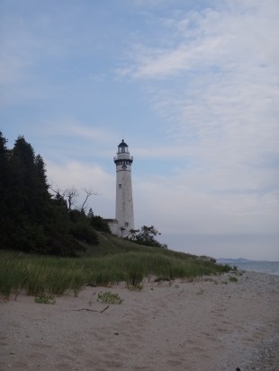
It seemed like every corner we turned was not putting us any closer to home but we just kept trudging on. Finally we could see the lighthouse in the distance which was a relief because it sat at the opening to the bay. Knowing the end was now in sight we picked up pace and soon climed the path up to the lighthouse (which was closed for visitors!!) and back out to the boat house and ferry dock. Happy that our dinghy hadn’t washed away (we had to rescue one earlier that was floating in the middle of the bay) we shoved off and went back to Serendipity fully exhausted. It was too late and we were too hungry for a dinner of grilled chicken so we settled on macaroni and cheese which tasted even better at that moment. It was a long day and I knew I’d be out the moment my head hit the pillow but it was completely rewarding to have spent five hours and close to 10 miles experiencing all the beauty that is Pure Michigan. (Thanks Tim Allen)
I knew he was starting to become a little bit of a hippie, but now a tree huger?
Matt at the bottom of the dune.


Sounds like fun guys. Keep sending pictures.
Tim Allen would bust a nut if he read you description of the island, that’s for sure! I love the pictures and being able to see and read what you are up too!
Funny – we are sailing Ariel, a 32 foot Morgan, new to us this spring. We are following your current adventures in your new boat on YouTube. We live in Frankfort, Michigan and have been trying to get to South Manitou all summer without success. We finally found our weather window this last weekend of September, crazy. I did a web search of “South Manitou harbor anchorage” to prepare for our arrival and your blog post popped up. We enjoyed reading your of experience. Since we’re so late in the season, everything was completely closed down. We shared the island with one national parks maintenance man. We hope to return next year. Our swimming/bathing experience was very similar – also about 66 degrees and took my breath away! But it was refreshing and since the air temperature was a record breaking mid 80s, we lounged around in the sunny cockpit to dry. Thank you for sharing your adventures with us!
I saw that Michigan was getting some crazy high temperatures this past week! A perfect time to sail out to South Manitou and take a dip in its frigid waters, haha. Really glad you enjoyed your time there, but it’s too bad it was so late in the season and everything was closed down. Oh, how I would love to spend a summer sailing the islands of the Great Lakes.